
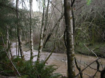
These proposed Wild and Scenic Rivers in the upper Eel River watershed provide important habitat for threatened and endangered salmon and steelhead, as well as wildlife dependent on old growth forests. They also provide outstanding opportunities for outdoor recreation.
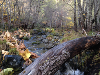
Deep Hole Creek flows through a proposed addition to the Yuki Wilderness. A tributary of Elk Creek, the stream provides suitable spawning and rearing habitat for coho salmon and steelhead. Federal officials identified the creek as essential for the recovery of threatened Chinook salmon and steelhead. The drainage also provides habitat for the spotted owl.
Management Agency: U.S. Forest Service ~ Six Rivers National Forest, Mendocino National Forest
Bureau of Land Management ~ Arcata Field Office
Location: Trinity & Mendocino Counties, CA 2nd Congressional District
Watershed: Upper Eel River
Wild & Scenic River Miles: 4.3 Miles
Outstanding Values: Anadromous fisheries, ecological, wildlife, cultural, scenery, recreation
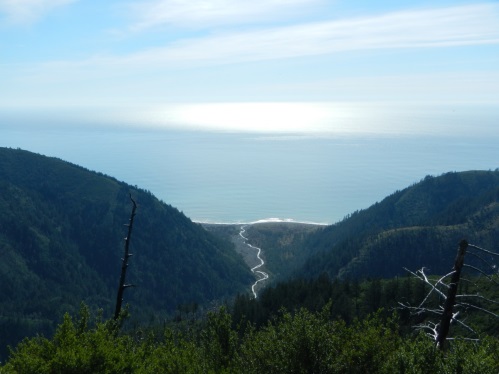 Located in the King Range Wilderness, this highly scenic stream is part of a unique coastal backcountry backpacking and camping area along the Lost Coast Trail. The stream also provides spawning and rearing habitat for steelhead and federal officials recently identified the creek as essential for the recovery of threatened steelhead. Several significant prehistoric sites are located near the stream.
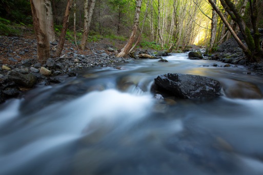 Located in the King Range Wilderness, this highly scenic stream is part of a unique coastal backcountry backpacking and camping area along the Lost Coast Trail. The stream also provides spawning and rearing habitat for steelhead.
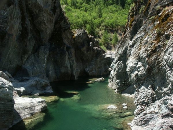
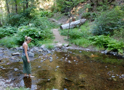 Bear Creek and its tributaries drain the eastside of the magnificent King Range. They provide suitable habitat for coho salmon and steelhead, as well as old growth forests for northern spotted owl. Federal officials recently identified the creek as essential for the recovery of threatened salmon and steelhead. Significant historic and prehistoric sites are located along the stream and a rare lichen grows there. Campgrounds popular with King Range visitors are located along Bear Creek, which is also the route of the popular Paradise Royale mountain bike trail.
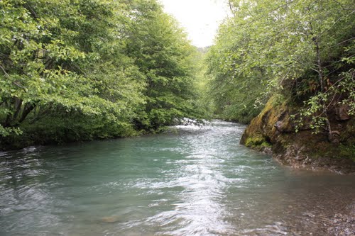 Honeydew Creek and its tributaries are in the King Range Wilderness. The creek provides suitable stream habitat for anadromous fish and old growth forest habitat for northern spotted owl. Federal officials recently identified the creek as essential for the recovery of threatened salmon and steelhead.
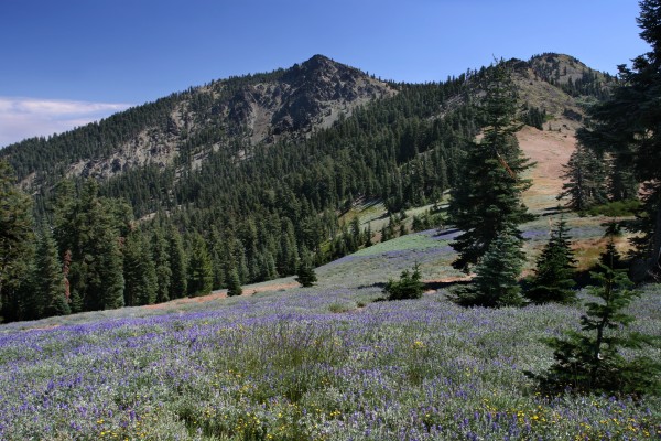 The proposed additions in the South Fork Trinity River watershed are dominated by the northern faces of Black Rock Mountain and North Yolla Bolly.
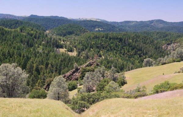
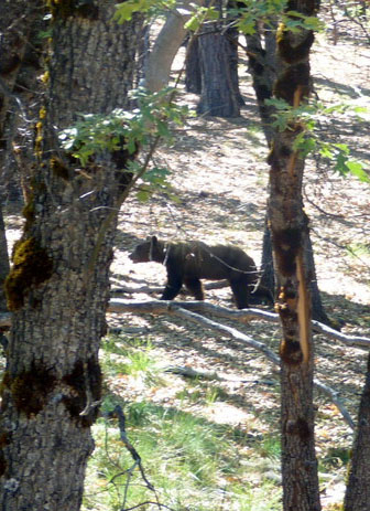 The South Fork Trinity provides critically important habitat for salmon and steelhead. The popular Rat Trap Gap, Black Rock Lake, North Yolla Bolly Lake and Stuart Gap trails all pass through the proposed wilderness additions. The proposed wilderness additions in the North Fork Eel River watershed, by contrast, are dominated by low-elevation V-shaped canyons draped with grasslands, oak woodlands, and chaparral.
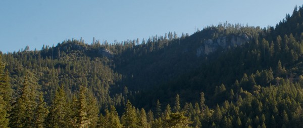 The Wild and Scenic South Fork Trinity River winds its way through lower elevation hardwoods that include madrone, maple, chinquapin and oak.
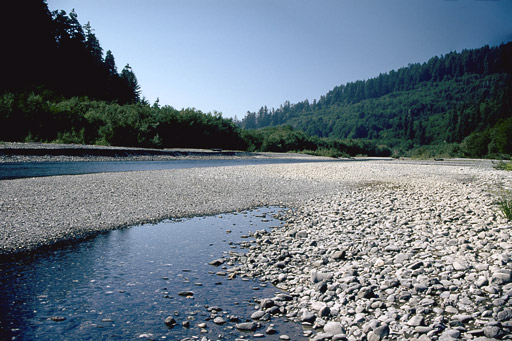
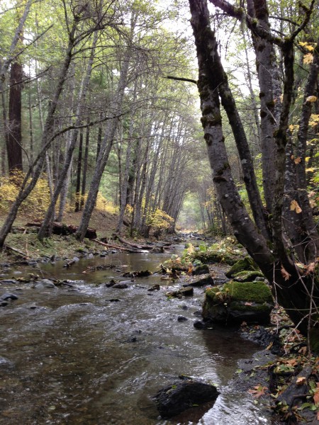 The South Fork Trinity River is one of the largest undammed river systems in California. The river and its tributaries support important populations of threatened and endangered salmon and steelhead and old-growth forest dependent wildlife species. The river and tributaries also offer outstanding outdoor recreation opportunities.
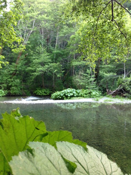 The South Fork Trinity River is one of the largest undammed river systems in California. The river and its tributaries support important populations of threatened and endangered salmon and steelhead and old-growth forest dependent wildlife species. The river and tributaries also offer outstanding outdoor recreation opportunities.
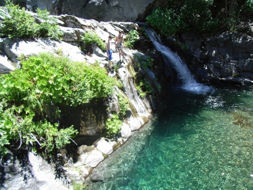
 The Headwaters Forest Reserve encompasses the headwaters of the Little South Fork Elk River and Salmon Creek. These streams are key components of the old-growth redwood forest community. The ecological values of the streams include unparalleled diversity of plant and animals species, including old growth redwoods, marbled murrelet, northern spotted owl, bald eagle, Coho and Chinook salmon, and steelhead. Salmon Creek in particular is dominated by old growth redwood forest and possesses abundant woody debris and deep pools – key habitat features needed for healthy salmon and steelhead fisheries. The stream corridors are also rich in historic and prehistoric resources.
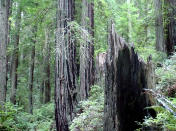
 These proposed Wild and Scenic Rivers flow from the magnificent Trinity Alps Wilderness, providing important habitat for salmon and steelhead migrating to and from the Trinity River, as well as outstanding outdoor recreation opportunities and scenery.
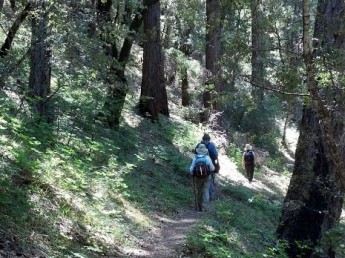 This proposed wilderness is located along the canyon of the South Fork Trinity Wild and Scenic River.
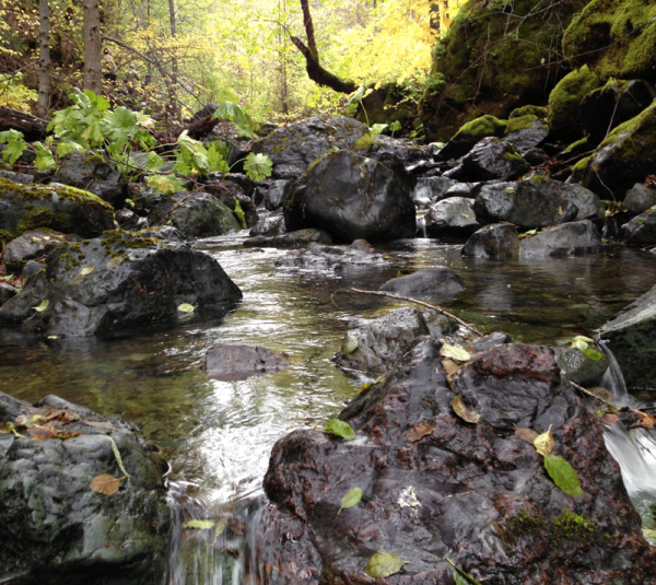 The South Fork Trinity River is one of the largest undammed river systems in California. The river and its tributaries support important populations of threatened and endangered salmon and steelhead and old-growth forest dependent wildlife species. The river and tributaries also offer outstanding outdoor recreation opportunities.
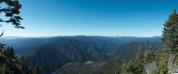 The southern proposed additions are composed of rugged, heavily forested mid to low-elevation country that would complement the adjacent highlands of the Trinity Alps Wilderness if protected.
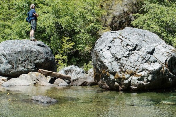 If Bigfoot lives, he or she dwells in the Siskiyou Mountains. The northwestern portions of the proposed wilderness additions are in the Smith River and Illinois River watersheds.
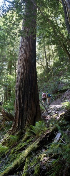
 This is the closest proposed wilderness to the greater Humboldt Bay area, thus making it an excellent destination for day-visits from Humboldt County. The Bug Creek Trail provides access to the area and offers views to the King Range, Trinity Alps, Mount Shasta, Yolla Bollys and beyond.
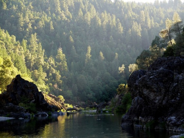 The proposed wilderness is covered with an ancient forest of Douglas fir, live and black oak, ponderosa pine, sugar pine, tan oak, and other species.
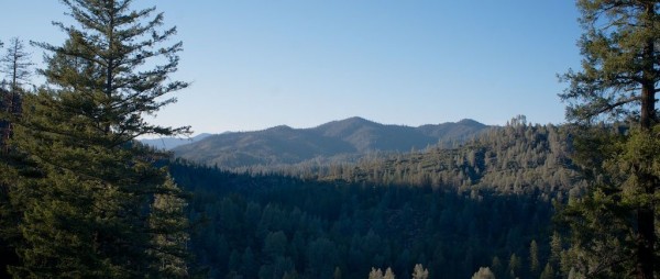 The Chanchelulla Wilderness is an extremely rugged landscape with rocky, sparsely-forested ridgetops, old-growth dominated northern exposures and chaparral-draped south-facing slopes. Visitors to the area are greeted with outstanding views in all directions, including distant Mount Shasta, Lassen Peak, the Sierra Nevada, the Yolla Bollys, the Trinity Alps and beyond.
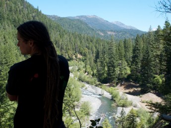
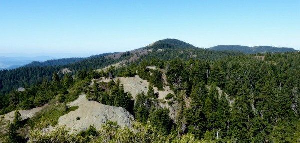
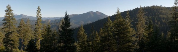 This strikingly rugged region is characterized by steep, mountainous terrain, with elevations ranging from 2,500 feet along the Trinity River to 7,000 feet along the Bonanza King Divide that commands spectacular views of the surrounding countryside, including the Trinity Alps Wilderness to the west and Mount Shasta to the northeast.
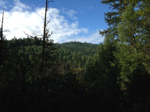 The proposed wilderness contains what is possibly the largest, most intact swath of unprotected ancient forest in northern California.
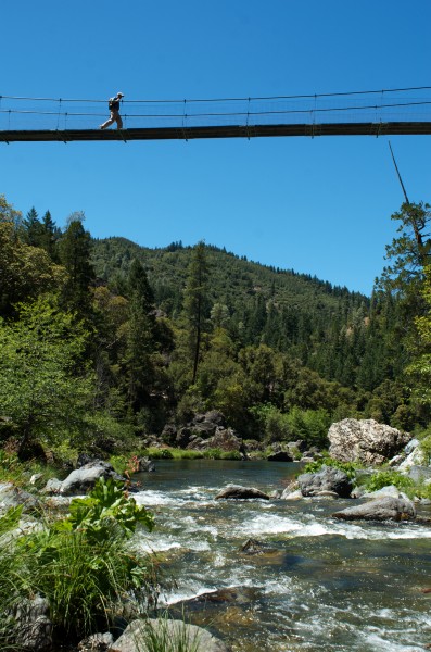 The South Fork Trinity River is one of the largest undammed river systems in California. The river and its tributaries support important populations of threatened and endangered salmon and steelhead and old-growth forest dependent wildlife species. The river and tributaries also offer outstanding outdoor recreation opportunities.
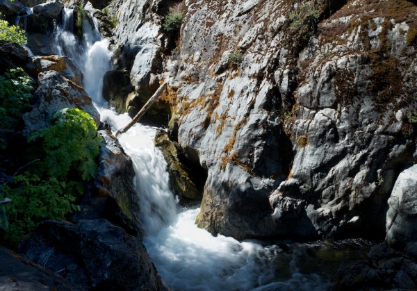
 The South Fork Trinity River is one of the largest undammed river systems in California. The river and its tributaries support important populations of threatened and endangered salmon and steelhead and old-growth forest dependent wildlife species. The river and tributaries also offer outstanding outdoor recreation opportunities.