Yolla Bolly – Middle Eel Proposed Wilderness Additions

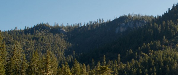
YollaBollyMiddleEel_1The proposed additions in the South Fork Trinity River watershed are dominated by the northern faces of Black Rock Mountain and North Yolla Bolly.

These prominent landmarks were inexplicably excluded from the Yolla Bolly-Middle Eel Wilderness when it was established in 1964.

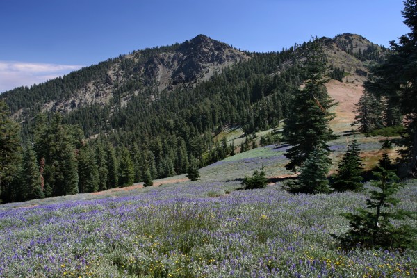
These areas contain rich old-growth forests that shelter northern spotted owl, goshawk, pileated woodpecker and other species. The prominent ridge that forms these peaks is also dappled with small, yet rich springs and meadows that serve as the source of the East Fork South Fork Trinity River.
YollaBollyMiddleEel_2The South Fork Trinity provides critically important habitat for salmon and steelhead. The popular Rat Trap Gap, Black Rock Lake, North Yolla Bolly Lake and Stuart Gap trails all pass through the proposed wilderness additions. The proposed wilderness additions in the North Fork Eel River watershed, by contrast, are dominated by low-elevation V-shaped canyons draped with grasslands, oak woodlands, and chaparral.

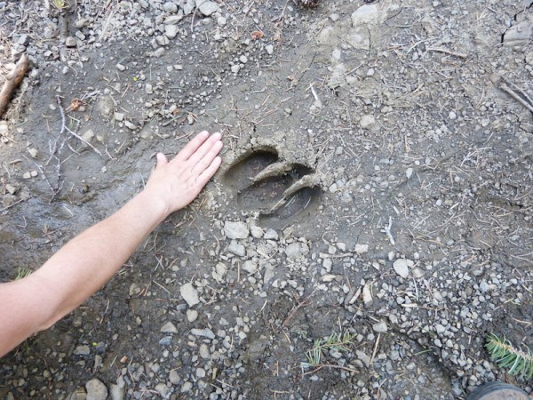
Protecting Casoose Creek (a proposed wild and scenic river) and other key streams on the western flank of the Yolla Bollys would be an important step in the effort to restore the North Fork’s anadromous fish populations. These lowlands also offer critically-important summer and winter range for deer, habitat that is rapidly being lost to development elsewhere in the state.

South Fork Trinity Proposed Wilderness

SouthForkTrinityPWAThe Wild and Scenic South Fork Trinity River winds its way through lower elevation hardwoods that include madrone, maple, chinquapin and oak.
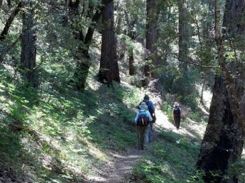
Further up the slopes, old-growth forests composed of pine, fir and cedar are found. These groves provide habitat for large mammals such as mountain lion and their frequent prey, the Columbian blacktail deer.
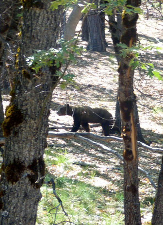
Black bear are also abundant in the canyon.

Occasionally, one may observe the endangered spotted owl, as well as goshawks and falcons. Along the river, red-legged frogs and pacific salamander, both threatened species, may be found along with other aquatic wildlife such as the river otter.

This segment of the South Fork provides some of the best spawning grounds on the stream for salmon and steelhead. Plummer Creek, a major tributary of the South Fork, hosts a native steelhead run and provides the Trinity with a valuable source of cool water.

Recreational opportunities are abundant, as the river provides whitewater rafters and kayakers with challenging spring runs and the swimmer refreshing pools for swimming. Trails give hikers access to some of California’s most scenic areas.

The world’s tallest ponderosa pine was recently located in the area. According to the Redding Record Searchlight, “The tree is 240 feet tall, or as tall as a 24-story building; trunk circumference of 290 inches, or almost 8 feet wide and a crown width of 70 feet.”

Underwood Proposed Wilderness

UnderwoodThis proposed wilderness is located along the canyon of the South Fork Trinity Wild and Scenic River.
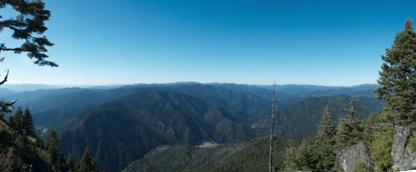
Recreational opportunities abound in Underwood with boating, hiking and wildflower viewing in the spring followed by swimming in its many pools during the summer. One can often see salmon and steelhead holding in these same pools in the summer and spawning in the fall. The proposed wilderness hosts a fall run of Chinook salmon as well as a lesser run of coho salmon.

Fishing opportunities for trout attract many anglers. For some 5 miles, the South Fork Trail winds through the steep and rugged terrain above the river. This trail is popular with hunters and hikers, and is used for river access by anglers. Spring wildflower displays can often be quite stunning.

South Fork Mountain, which forms the approximate western boundary of the proposed wilderness, is notable for being the longest ridge found in the western hemisphere.

Underwood provides important habitat for mountain lion and bear, as well as raptors such as eagle and osprey. Along the river, both otter and mink are found.

Trinity Alps Wilderness Proposed Additions

Trinity Alps AdditionsThe southern proposed additions are composed of rugged, heavily forested mid to low-elevation country that would complement the adjacent highlands of the Trinity Alps Wilderness if protected.
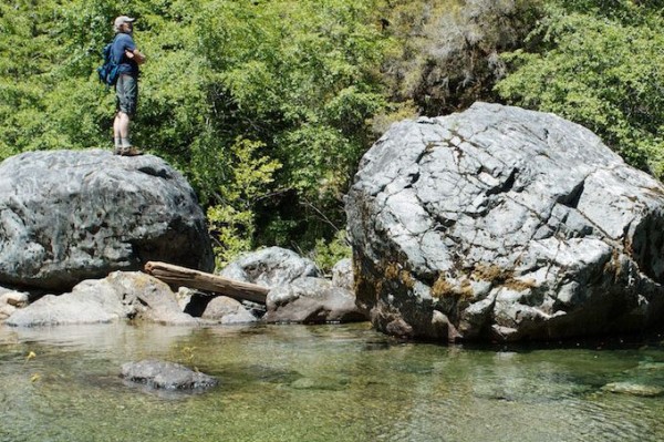
The Wild and Scenic New River, Canyon Creek Proposed Wild and Scenic River and other streams that flow out of the proposed additions provide cold, clear water essential for the survival of endangered steelhead trout and coho and Chinook salmon populations in the Trinity River. Large boulders and abundant small waterfalls grace many of these streams, and the fish can often be seen leaping up the rapids to spawn.

The New River watershed is well known for its purity, even during fierce rainstorms. The proposed additions are an extremely important refuge for unique and endangered species, including nine rare plants. Reminders of the area’s Gold Rush history abound in the proposed additions in the form of abandoned mines, rock piles, and ditches. As is the case in the adjacent Trinity Alps Wilderness, these disturbances are more often than not covered by vegetation, and do not in any way detract from the region’s overall wild character. Indeed, these historical features simply add to the public’s fascination with this wild, remote country. The New River offers challenging whitewater for boaters who are brave enough to negotiate its narrow gorge filled with deep troughs and house-sized boulders.


Siskiyou Wilderness Proposed Additions

SiskiyouSmithIf Bigfoot lives, he or she dwells in the Siskiyou Mountains. The northwestern portions of the proposed wilderness additions are in the Smith River and Illinois River watersheds.
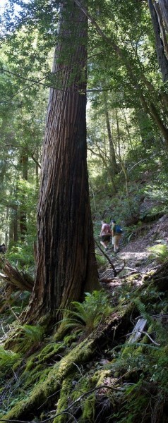
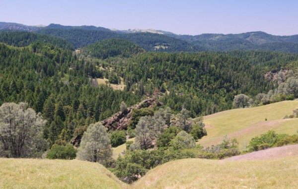
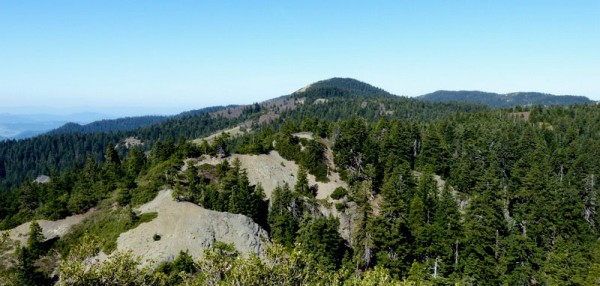
The Smith is California’s only undammed river and it hosts one of the “best salmon and steelhead fisheries on the west coast” according to the Six Rivers National Forest. The stream is known for its beautiful blue-green color, scenic vistas, challenging whitewater, abundant fish and other wildlife populations, rare plants and recreation opportunities. These superlative features lead Congress to designate the California-portion of the watershed the Smith River National Recreation Area in 1990.

A significant portion of the Smith’s headwaters are protected by the Siskiyou Wilderness. Unusual soils, great rises and drops in elevation, and plenty of water all combine to make the Siskiyou Wilderness a refuge for a great diversity of species, many of which are found nowhere else on earth. Ancient forests consist of an amazing fourteen species of conifers, the second greatest conifer diversity in the world.

PortOrford

North Fork Eel Proposed Wilderness Additions

SONY DSC

The proposed additions are clustered along the canyon of the North Fork Eel Wild and Scenic River which is where the North Fork Wilderness is situated.

The existing 8,100-acre North Fork Wilderness is almost certainly the least visited of all of northern California’s designated wilderness areas. This lack of visitors is not due its features or habitat, but simply because it is located far from any major thoroughfares and population centers in extremely remote, rugged country.

The proposed additions shelter important low-elevation old-growth forest as well as wildflower-dappled grasslands, oak woodlands and chaparral. The area is known to be used by peregrine falcons, the world’s fastest bird that can reach speeds in excess of 200 miles an hour when diving for prey.

The North Fork Eel provides habitat for coho salmon and steelhead trout in its rugged and beautiful canyon. Red Mountain Creek Proposed Wild and Scenic River, a tributary of the North Fork that drains a large portion of the Yolla Bolly-Middle Eel Wilderness to the east, also hosts steelhead trout and provides cold, clear water essential for the health of the river.

Bluff Creek, another tributary that flows through the additions, provides habitat for both coho salmon and steelhead. Lastly, the North Fork Eel provides challenging whitewater opportunities for experienced kayakers and rafters. The additions are mostly trackless, though there are a few rugged historic trails through the region.

Mad River Buttes Proposed Wilderness

Mad River Buttes

This small yet ecologically diverse proposed wilderness encompasses the headwaters of Redwood Creek, a critical salmon and steelhead trout stream that eventually flows into Redwood National Park to the north.

Redwood Creek flows off of the north-face of this ridge, while Bug Creek (an important tributary of the Mad River to the south) flows from its southern slopes. Large meadows grace the region, offering breathtaking wildflower displays in early summer.

Ancient forests of pine and fir cover much of the area, as do outstanding groves of black oaks. These diverse habitats provide homes for a large number of wildlife species, including the northern spotted owl, goshawk, Pacific fisher, pine marten, Pacific giant salamander, prairie falcon, pileated woodpecker, and Roosevelt elk among others. Unique plant communities are also formed by “serpentine barrens,” places where soil conditions are so poor that only highly specialized plants can survive.

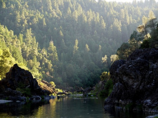
MRiverElkThis is the closest proposed wilderness to the greater Humboldt Bay area, thus making it an excellent destination for day-visits from Humboldt County. The Bug Creek Trail provides access to the area and offers views to the King Range, Trinity Alps, Mount Shasta, Yolla Bollys and beyond.
 

English Ridge Proposed Wilderness

English RidgeThe proposed wilderness is covered with an ancient forest of Douglas fir, live and black oak, ponderosa pine, sugar pine, tan oak, and other species.
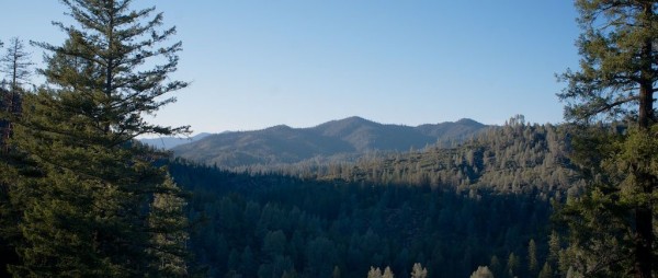
The Wild and Scenic Eel River bisects the western portion of English Ridge from south to north, in fact, the river provides the only legal public access to the area because it is surrounded by private land.

The Bureau of Land Management (BLM) found Fish Creek and Indian Creek (two tributaries of the Eel) in the proposed wilderness to be eligible for wild and scenic river status because of their old-growth forests and habitat for salmon and steelhead.

The forested slopes in the area are nearly trackless, so most recreation use consists of kayaking, canoeing, and rafting the Eel River.

In 2011 the Department of the Interior released a report highlighting BLM lands around the nation that ought to be designated as wilderness by Congress. It included English Ridge among what it called these “crown jewels” of the BLM’s potential wilderness portfolio.

Chanchelulla Proposed Wilderness Additions

ChanchellulaThe Chanchelulla Wilderness is an extremely rugged landscape with rocky, sparsely-forested ridgetops, old-growth dominated northern exposures and chaparral-draped south-facing slopes.  Visitors to the area are greeted with outstanding views in all directions, including distant Mount Shasta, Lassen Peak, the Sierra Nevada, the Yolla Bollys, the Trinity Alps and beyond.

When the area was designated as wilderness in 1984, thousands of acres of ancient cedar, pine and fir forest, several cave-riddled outcrops of limestone and over four miles of Hayfork Creek (a key salmon and steelhead stream) were left out.

These potential additions to the wilderness host many rare or endangered plant and animal species, including northern spotted owl, goshawk, fisher, marten, Peanut sandwort (a delicate white flower), and Stebbins’ madia (a striking yellow flower with a sage-like smell).

While most of the proposed additions are trackless, a single historic trail follows the Potato Creek drainage and enters the existing wilderness.  Hayfork Creek has been rated as a very challenging class III-V kayak run by American Whitewater.

Bonanza King Proposed Wilderness

Bonanza King PhotoThis strikingly rugged region is characterized by steep, mountainous terrain, with elevations ranging from 2,500 feet along the Trinity River to 7,000 feet along the Bonanza King Divide that commands spectacular views of the surrounding countryside, including the Trinity Alps Wilderness to the west and Mount Shasta to the northeast.
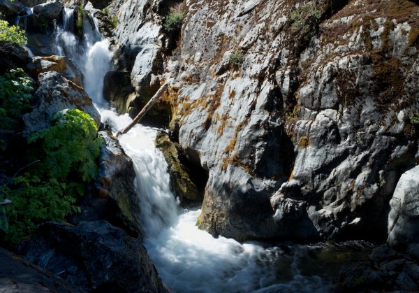
These steep slopes are cut by numerous small creeks and ravines, with ancient forests, lakes, meadows, oak woodlands, and grasslands in between. The area is noted for its exceptional botanical diversity due to unusual geology and a large number of wet seeps and meadows. These wet areas provide spectacular wildflower displays over a long blooming season, while also providing habitat for many sensitive plants and trees, including the rare and beautiful Port Orford cedar.

As the name “Bonanza King” implies, the region was pored over by prospectors in the Nineteenth Century. Like the nearby Trinity Alps Wilderness, physical reminders of this mining boom are not hard to find in the form of abandoned equipment and old, primitive structures.

Pattison Proposed Wilderness

Corral Creek in Pattison Proposed Wilderness Area - photo: Jason Smith
Corral Creek in Pattison Proposed Wilderness Area – photo: Jason Smith

Close to the confluence of the South Fork Trinity River and Hayfork Creek, the Pattison Proposed Wilderness provides outstanding opportunities for outdoor recreation and refuge for threatened and endangered salmon and steelhead. Old growth and mixed hardwood forests provide important habitat for endangered spotted owl and other wildlife.

Young wilderness enthusiasts from the Bar 717 Ranch’s Camp Trinity hike, ride horses, and camp in the Pattison area and frequent the many swimming holes in Hayfork Creek. Many Pattison trails served as key transportation routes for both Native Americans and early western pioneers. Hayfork Bally and Pattison Peak may be climbed by the adventurous. Fishing in Hayfork Creek and other streams is a popular pastime for locals and visitors to the area. During the high water season, expert kayakers challenge Hayfork Creek’s class IV-V whitewater.

Miner’s Creek and other Hayfork tributaries, provide important cold water refuges for threatened and endangered salmon and steelhead that migrate up the South Fork Trinity River and into Hayfork Creek to spawn. The U.S. Forest Service has recommended Hayfork Creek for Wild & Scenic River protection to preserve its outstanding fishery and scenic values.  The Trinity County Board of Supervisors supported wilderness protection for the Pattison area in 1978.